
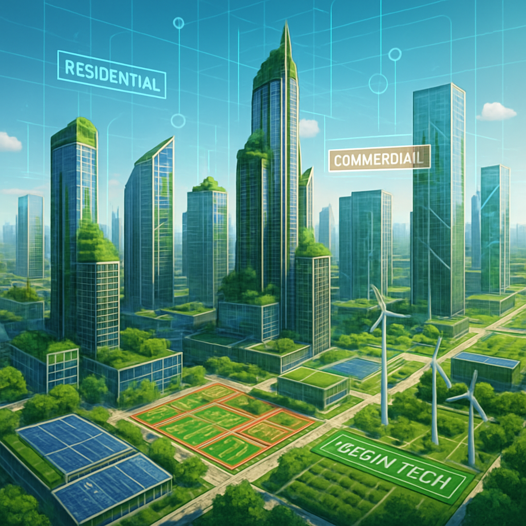
Green tech zones and smart environmental zoning with AI
TL;DR: Green tech zones are planned areas where clean-energy manufacturing, circular-economy industries, and low-impact infrastructure cluster to cut emissions and resource use. Eco policies and incentives are shifting where and how people, industry, and nature co-exist, changing future geography. Planners use AI, remote sensing, and digital twins to make zoning smarter, faster, and more adaptive. Below you’ll find concepts, mechanisms, step-by-step implementation, real-world examples, common misconceptions, and SEO-ready headings and meta copy. UNIDO+1
What are green tech zones? (definition and core ideas)
Green tech zones are purpose-built or policy-supported geographic areas that concentrate sustainable industries, renewable energy assets, circular-economy enterprises, and green infrastructure. The goal is to maximize resource efficiency, minimize pollution, and create economies of scale for low-carbon technologies. These zones come in several flavors: eco-industrial parks that trade heat and byproducts, research and innovation clusters for clean tech, and municipal green districts that combine housing, transit, and green infrastructure. They are increasingly guided by international frameworks and best practices. UNIDO+1
Why they matter
- They reduce transport and energy loss by co-locating complementary activities.
- They make decarbonization policies executable at local scale.
- They attract green investment through targeted incentives and clear permitting. ENGIE Impact
How eco policies reshape future geography (short and concrete)
Policy choices determine where infrastructure and people concentrate or disperse. Expect these geographic effects:
- Industrial relocation and clustering. Incentives for zero-carbon parks and green industrial zones push manufacturing toward areas with renewable grid access, waste exchange networks, and logistics hubs. This changes traditional industrial corridors. ScienceDirect+1
- New energy geographies. Large-scale solar, wind, and storage create “energy landscapes” where land use is organized around generation potential and transmission lines. Coastal, desert, and plateau areas may see major land-use shifts.
- Urban form and densification. Climate and resource policies favor compact, transit-rich development with integrated green corridors to reduce per-capita emissions.
- Managed retreat and conservation corridors. Policies for climate resilience create new protected areas and migration corridors, shifting land uses away from high-risk zones.
- Data-driven zoning and micro-geographies. With fine-grained environmental data, zoning maps will split into much smaller, function-specific parcels (for biodiversity, stormwater, heat management, and more). Open Knowledge Base
Smart environmental zoning using AI — what it is and how it works
Smart environmental zoning means using data, models, and algorithms to design zoning rules and land-use policies that optimize for multiple goals: emissions reduction, flood resilience, biodiversity, and social equity.
Core building blocks
- Data: remote sensing (satellite, LiDAR), sensors, cadastral and infrastructure maps.
- Models and algorithms: machine learning for land-suitability and risk mapping, optimization models for locating infrastructure, and simulation tools like agent-based models for scenario testing.
- Decision interfaces: GIS dashboards, policy sandboxes, and digital twins that let planners test zoning outcomes before adoption. MDPI+1
Common AI methods used
- Supervised learning to map land cover and predict flood or heat hotspots.
- Unsupervised learning to cluster similar parcels for policy targeting.
- Multi-objective optimization to balance green-space, housing, and industry.
- Reinforcement learning to optimize phased development under uncertainty. MDPI
Step-by-step: how a city or region implements smart environmental zoning
- Define policy goals. Clear aims matter. Examples: net-zero emission by 2040, 30 percent green cover, or reduce flood exposure 50 percent.
- Assemble and clean data. Collect satellite imagery, LiDAR, soil maps, infrastructure GIS, emissions inventories, social vulnerability layers, and permits. Use platforms such as Google Earth Engine for scalable processing. MDPI
- Run diagnostic models. Use ML to map hazards, ecosystem services, and land suitability. Produce themed maps: renewable potential, flood risk, biodiversity value, and industrial synergies. ScienceDirect+1
- Co-design scenarios with stakeholders. Test scenarios with business, community groups, and agencies. Use interactive dashboards or a digital twin to visualize outcomes. The Times of India
- Produce zoning options and optimization. Apply multi-criteria optimization to create zoning proposals that balance goals.
- Pilot policies in green tech zones. Start with limited pilots such as an eco-industrial cluster or a green district to prove the model. Kalundborg-style symbiosis is a well-studied example. ENGIE Impact
- Monitor and adapt. Use sensors and periodic remote-sensing reassessments to update zoning and permit adaptive management.
Real-world examples and case studies
- Kalundborg industrial symbiosis is a landmark example of resource sharing among industries that cut waste and energy use. Its lessons inform modern eco-industrial parks worldwide. ENGIE Impact+1
- International EIP frameworks. The World Bank, UNIDO, and partners offer guidelines for eco-industrial park development to scale best practices and policy instruments. These frameworks connect investment, environmental safeguards, and planning design. UNIDO+1
- China’s green industrial park policies. Over the last two decades China has promoted green transformation of industrial parks and more recently moved toward zero-carbon industrial parks, shifting major manufacturing geographies through policy. This shows how central policy can remap regional land uses. ScienceDirect+1
- AI + Earth observation for flood zoning. Researchers have combined Sentinel imagery, machine learning, and the Google Earth Engine to produce rapid urban flood-risk assessments that feed directly into zoning decisions. This accelerates evidence-based policy in flood-prone cities. ScienceDirect+1
- Digital twin and LiDAR for resilience planning. Municipal digital twins built with LiDAR and dozens of thematic layers are already being used to identify flood-vulnerable parcels and plan evacuation, infrastructure, and zoning changes in near-real time. The Times of India
Practical tools and tech stack (short list)
- Data platforms: Google Earth Engine, OpenStreetMap, national cadastral data. MDPI
- GIS software: QGIS, ArcGIS Pro.
- ML libraries: scikit-learn, TensorFlow, PyTorch.
- Simulation: NetLogo, AnyLogic, urban digital twin platforms.
- Standards and frameworks: UNIDO/World Bank EIP guidelines and national green park policies. UNIDO+1
Common misconceptions
- AI will replace planners. No. AI augments planners with better data and scenarios. Human values and politics still decide trade-offs.
- Green tech zones are only for rich countries. Not true. With the right financing and international frameworks, many low and middle income regions implement eco-industrial parks. UNIDO
- Zoning fixes everything. Zoning is one tool. Social policy, finance, and community engagement are equally vital for equitable outcomes.
- A single model fits all places. Local ecology, culture, and economy require place-based adaptation of models and policies.
Policy recommendations and design principles
- Set measurable targets. Tie zoning to measurable climate and resilience goals.
- Prioritize interoperability and open data. Shared datasets speed decision making and allow third-party innovation.
- Start small, scale fast. Pilot green tech zones and iterate based on monitoring. ENGIE Impact
- Combine incentives with regulation. Use tax, land leases, and expedited permitting alongside performance standards.
- Embed equity checks. Ensure zoning reduces rather than increases displacement and environmental injustice.
Green tech zones are transforming how cities, industries, and communities interact with natural resources, thanks to emerging eco policies and the integration of smart zoning powered by AI. The resulting shift in geography will create more sustainable, resilient, and efficient urban environments, profoundly changing landscapes worldwide.
Green Tech Zones: Definition and Impact
Green tech zones are designated regions focused on expanding the use of environmentally friendly technologies and sustainable practices, aiming to reduce pollution, conserve resources, and regenerate local ecosystems. They often host renewable energy infrastructure, advanced waste management systems, and green buildings. Their core purpose is to pioneer low-carbon growth and funnel investment into innovation hubs that encourage clean energy, electrification, sustainable construction, and regenerative agriculture.
- Keywords: Green tech zones, sustainable urban development, renewable energy, eco-friendly cities, climate-resilient regions, carbon-negative businesses.
Changing Geography with Eco Policies
Eco policies shape the geographical distribution of human activities by incentivizing sustainable land use and protecting critical natural resources. Geography, in turn, determines where green tech can be most effective:
- Solar farms thrive where there is abundant sunlight (like deserts or tropical regions).
- Coastal areas prioritize flood resilience and renewable tidal power.
- Remote sensing and geographic data guide site selection for wind turbines and hydroelectric plants.
As eco policies push stricter land use regulations, cities may see new green corridors, increased green belt zones, and strategic zoning for carbon sequestration and biodiversity enhancement. This can alter urban sprawl, concentrate growth around transit hubs, and reshape regional development.
Smart Environmental Zoning Using AI
AI is revolutionizing urban planning by making zoning dynamic, adaptive, and responsive to real-time environmental, economic, and social data. Smart environmental zoning involves:
- Data Integration: AI combines Geographic Information Systems (GIS), IoT sensors, satellite imaging, and traffic flows to model environmental impacts quickly and accurately.
- Adaptive Zoning: Unlike static zoning maps, AI-enabled zones shift in response to current realities—population density, air quality, flood risks, and heat island effects.
- Scenario Simulation: Planners can preview outcomes of policy changes instantly, optimizing land use for sustainability, cost, and equity (such as expanding green buffers during extreme heat or increasing transit connectivity during peak hours).
- Automated Compliance: AI checks building plans for climate standards, safety, and accessibility automatically, reducing human error and speeding up approvals.
- Keywords: Smart environmental zoning, AI urban planning, GIS, adaptive zoning, digital twins, IoT, real-time city management.
Step-by-Step Process: Smart Green Zoning
- Assessment: Collect geographic, demographic, and environmental data using smart sensors and GIS.
- AI Simulation: Feed data into AI models that simulate the impact of different zoning regulations and infrastructure options.
- Policy Recommendation: AI recommends optimal zoning changes tailored to climate goals, resource efficiency, and population needs.
- Implementation: Local governments designate green tech zones, incentivize eco-businesses, and enforce regulations.
- Continuous Feedback: IoT devices provide ongoing data, allowing AI to adjust zoning in real time for emergencies, growth, or new sustainability targets.
Real-World Applications
- Singapore: Smart zoning uses AI-driven sensors to balance development and green space, automatically shifting commercial and residential boundaries for optimal use.
- Stockholm: Green tech districts focus on renewable energy, sustainable transportation, and net-zero neighborhoods.
- Dubai: AI solutions model climate impacts for heat and water scarcity, leading to advanced cooling systems and landscape changes.
- US Cities: Solar energy zones adapt to grid demand, and land use maps change to address wildfire risk using real-time environmental data.
Common Misconceptions
- Green tech zones equal “no development”: In reality, they encourage sustainable development and responsible growth, not prohibit it.
- AI zoning is biased/unstable: AI only provides recommendations based on quality data; human oversight is crucial to prevent algorithmic bias and digital divide issues.
- Eco policies stifle economic growth: The evidence shows eco policies can spur innovation, attract investment, and even deliver “win-win” outcomes for both environment and economy.
Theories and Perspectives
- Regenerative Geography: Moves beyond sustainability to actively restore land, water, and biodiversity through green tech practices.
- Economic Geography: Examines how eco policies shift agglomeration, shaping clusters of green innovation and new labor patterns.
- Environmental Geography: Emphasizes the interplay between natural landscapes and human land use, highlighting trends like “rewilding” and climate adaptation.
Quick checklist for planners (actionable)
- Inventory existing industries, energy assets, and hazards.
- Run a high-resolution suitability model for green zoning. MDPI
- Create a pilot eco-industrial cluster with shared utilities and waste-exchange agreements. ENGIE Impact
- Deploy sensors and schedule quarterly remote-sensing reviews.
- Publish data and invite third-party modelers and startups to propose solutions.
Closing thoughts
Green tech zones and smart environmental zoning are complementary. Green zones concentrate low-carbon industry and infrastructure so resources are used efficiently. Smart zoning powered by AI and digital twins makes those zones adaptive, resilient, and transparent. The result is not only lower emissions, but also different maps. Coastal edges, deserts, old industrial belts, and even parts of cities will look different within a few decades as policy, technology, and market signals reweave the landscape. For planners the imperative is clear. Build the data foundations, run pilot zones, and embed social safeguards. The rest follows from good design and continuous adaptation. Open Knowledge Base+1